The early warning and marine forecast system of wind, currents and physical parameters, and wave is based on the operational forecasting system running numerical models including WRF, ROMS and SWAN, as described below:
-
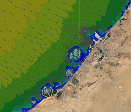
Meterological Model
The Weather Research Forecasting (WRF) meteorological model is used for resolving the atmospheric circulation and dynamics. Global Forecast System (GFS) produced by the National Center for Environmental Prediction (NCEP-NOAA) is used as the forcing of the mode. The atmospheric conditions from the GFS are downscaled for the Arabian Gulf and Dubai coast domains. The main predictive data are air pressure, temperature, specific humidity, precipitation, total cloud, water condensate, turbulent kinetic energy and wind components.
-
Hydrodynamic Model
The Regional Ocean Model System (ROMS) is used to setup the hydrodynamic domains of both the Arabian Gulf with coarse resolution and Dubai coastal zone with fine resolution. The main model outputs are the water levels, currents, salinity and temperature.
-
Wave Model
The Simulating WAves Nearshore(SWAN) is was developed for the region using to simulate to model spatially-varying wind-induced wave conditions in the Arabian Gulf and Dubai regions. The key model outputs are the significant wave height, peak wave period and mean wave period and peak wave direction.
-
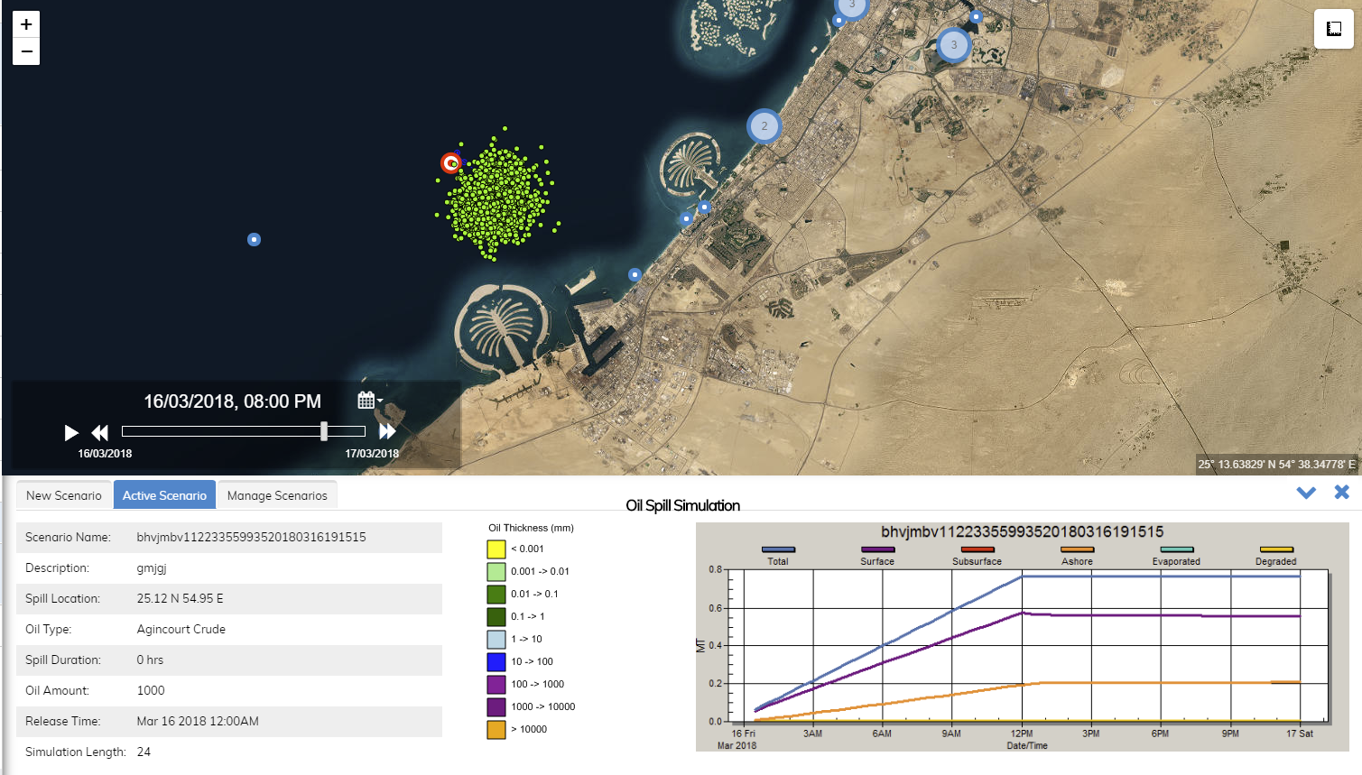
Oil Spill Model
A web based oil spill tool, OILMAP, is integrated with Dubai forecast system. This tool is capable of assessing the fate of oil spills released in the sea. It can be operated by a user at DM to predict the oil spill weathering and trajectory.
-
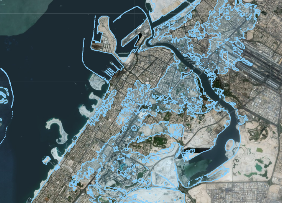
Inundation Layers
Inundation layers are available display predicted inundation of land adjacent to the coast and to Dubai creek due to the occurrence of abnormally high water levels depending on the predicted seawater elevation.